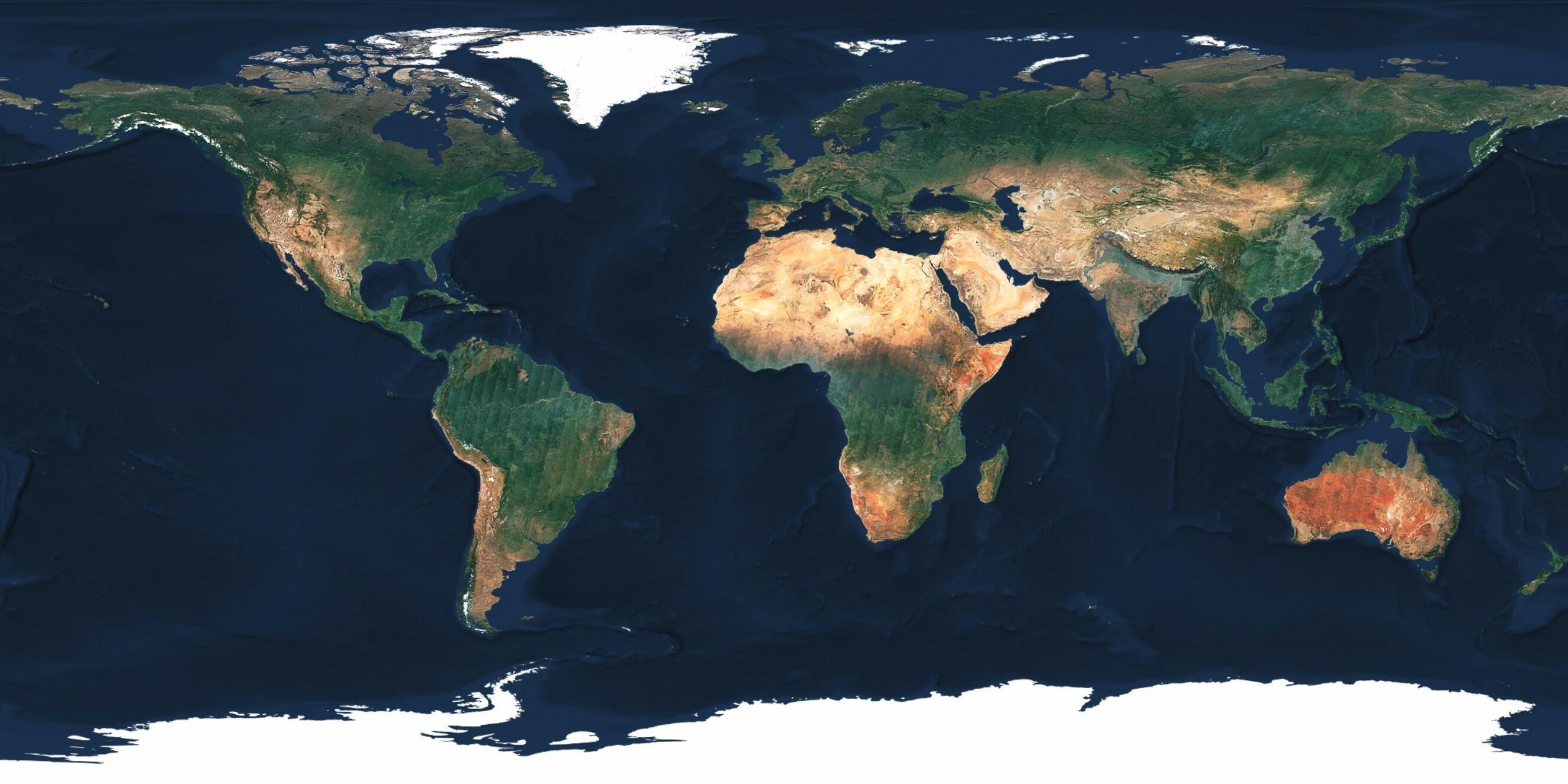
Sentinel-2 cloudless 2018
Good news everyone, there is an updated version of the Sentinel-2 cloudless map available!
After being first in having processed the whole Sentinel-2 archive to create a cloudless mosaic for 2016 it was time to use our experience and improve the processing to create an updated, new version. With the help of our new colleague Petr from Š.cartography (opens new window) we were able to develop various mosaicking methods which resulted in a new product: EOxCloudless (opens new window).
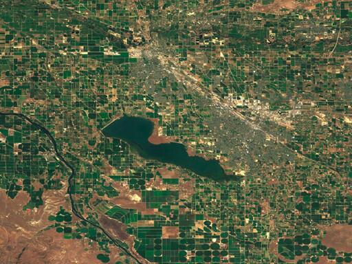
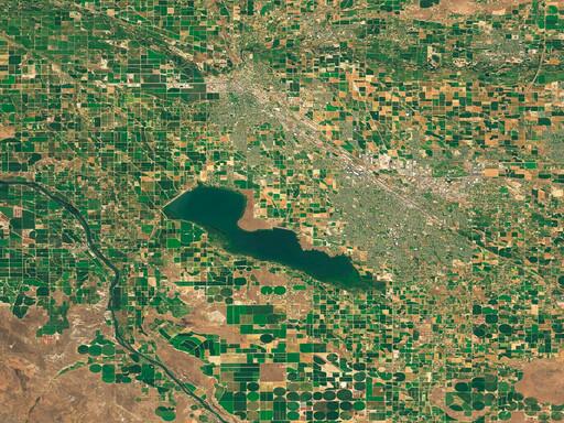
In direct comparison to the old layer from 2016 you will see a lot of visible improvements in the new version from 2018. There are a lot less clouds (we are approaching real cloud-free!), the colors are much more balanced and the overall integration with other map elements such as the ocean bathymetry was completely reworked.
# Less Clouds
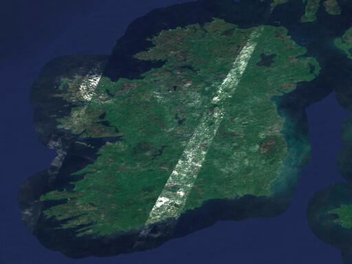
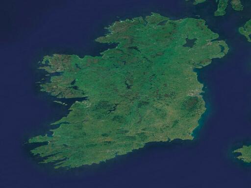
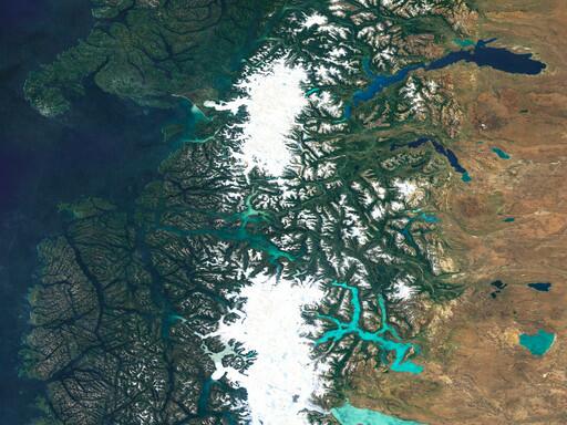
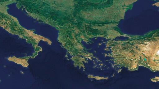
As much as we learned to love the cloudy stripe over Ireland in 2016, we were glad that we managed to have a cloud-free view of Ireland now.
very nice work! Ireland, though... :D
— Tõnis Kärdi (@tkardi) March 6, 2017
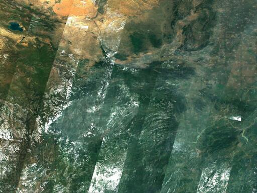
Also, there were many other problematic areas which now have much improved in the new version. There are a couple of reasons the new version dealt better with cloudy areas.
First, we developed and tested other methods of detecting and selecting cloud-free pixels from time stacks of data. This helped us to get good pixels with a higher probability than with the old method.
Second, since 2017 we now have data from the second of the two Sentinel-2 satellites at our disposal. This means we now have roughly twice as much observations as we had before but it also meant we had to process twice as much data. Therefore we also had to improve on pre-selecting the observations in a more intelligent way.
This especially paid of in regions which had poor coverage in 2016 such as the Americas and Asia.
We also used the multi-spectral properties of the Sentinel-2 sensors to better detect clouds and appended the near-infrared band to our output mosaics (opens new window).
# Post-processing
After extracting our cloudless pixels we also completely reworked the color balancing before we rendered the map. There is no atmospherically corrected data available on a global scale yet so we had to find a way how to create a satellite map which appears to be atmospherically corrected and which is visually appealing.
For this we made use of the great open-source tool rio-color (opens new window) which goes way beyond the linear color stretching we applied for the old version. The availability of the near-infrared band also enabled us to distinct between different land cover classes and apply fine-tuned color correction patterns for each patch.
This now results in brighter colors in higher latitudes and much more balanced colors for deserts and forests while maintaining a good brightness in build-up areas such as cities. In the end we also applied some selective smoothing and sharpening to accentuate water and land areas.
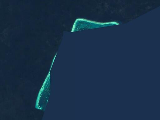
# Ocean Mask
Instead of having a discrete mask like in the old version to distinguish Land from Ocean, we now use a fuzzy mask to ensure a smooth transition. The buffer width is also dependent on the zoom level so as you zoom in, more and more from the Ocean is revealed.
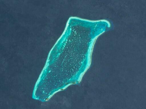
We also now not only include land masses but also reefs which were not present in the old version. This should also make Oceanographers happy!
# License Change
The 2016 version is provided for free under the Creative Commons Attribution 4.0 International Public License (opens new window) (CC BY 4.0) and the 2018 one under Creative Commons Attribution-NonCommercial-ShareAlike 4.0 International Public License (opens new window) (CC BY-NS-SA 4.0). The required attribution is "Sentinel-2 cloudless - https://s2maps.eu (opens new window) by EOX IT Services GmbH (opens new window)(Contains modified Copernicus Sentinel data 2016 & 2017)" for 2016 and "Sentinel-2 cloudless - https://s2maps.eu (opens new window) by EOX IT Services GmbH (opens new window)(Contains modified Copernicus Sentinel data 2017 & 2018)" for 2018 respectively. It shall include the links as given here in on-line usage.
For commercial usage we offer the data (opens new window) under the EOX Commercial Attribution-RestrictedUse 1.0 License (opens new window) which is based on CC BY. The main change over CC BY is that EOX reserves the right to provide the data with this license. You're entirely free to use it in your services and products, you just can't transfer this license to your users. Usage examples include a WMTS you provide under your name or a product you sell that bundles the data for offline usage.
# EOxCloudless
Are you interested in getting the rendered map, the mosaic used, or order a custom mosaic? Come over to EOxCloudless (opens new window) and let us help you out!