
Top 5 trends in EO data usage
In the following I'm going to summarize and present my personal view on current trends in today's access and usage of Earth Observation (EO) data. As this is a subjective analysis I invite you, dear reader, to share your thoughts with me, best on Twitter. I might be convinced to write a follow-up post, although this one is going to be quite long anyway 😉
# tl;dr
My personal top 5 trends in EO data access and usage are:
- simple apps for single use cases are popular
- apps are browser based and even run on mobile devices
- more and more EO data is released as Open Data
- the map becomes the central user interface element
- there are more commercial opportunities also for smaller companies
Let me know your top trends, best via Twitter, or read on to see examples of these trends and a more detailed analysis.
# User Interface Comparison
Let me start by showing and comparing several user interfaces of apps for obtaining EO data. The comparison and analysis uses the freely available Landsat data (opens new window) and the images show this data whenever possible. Only apps providing access to or using Landsat data have been selected in order to prepare for the Sentinel missions, particularly for Sentinel 2, which also offer the data as Open Data like Landsat. Of course the list is far from being complete and I'd be interested to know which one you would add?
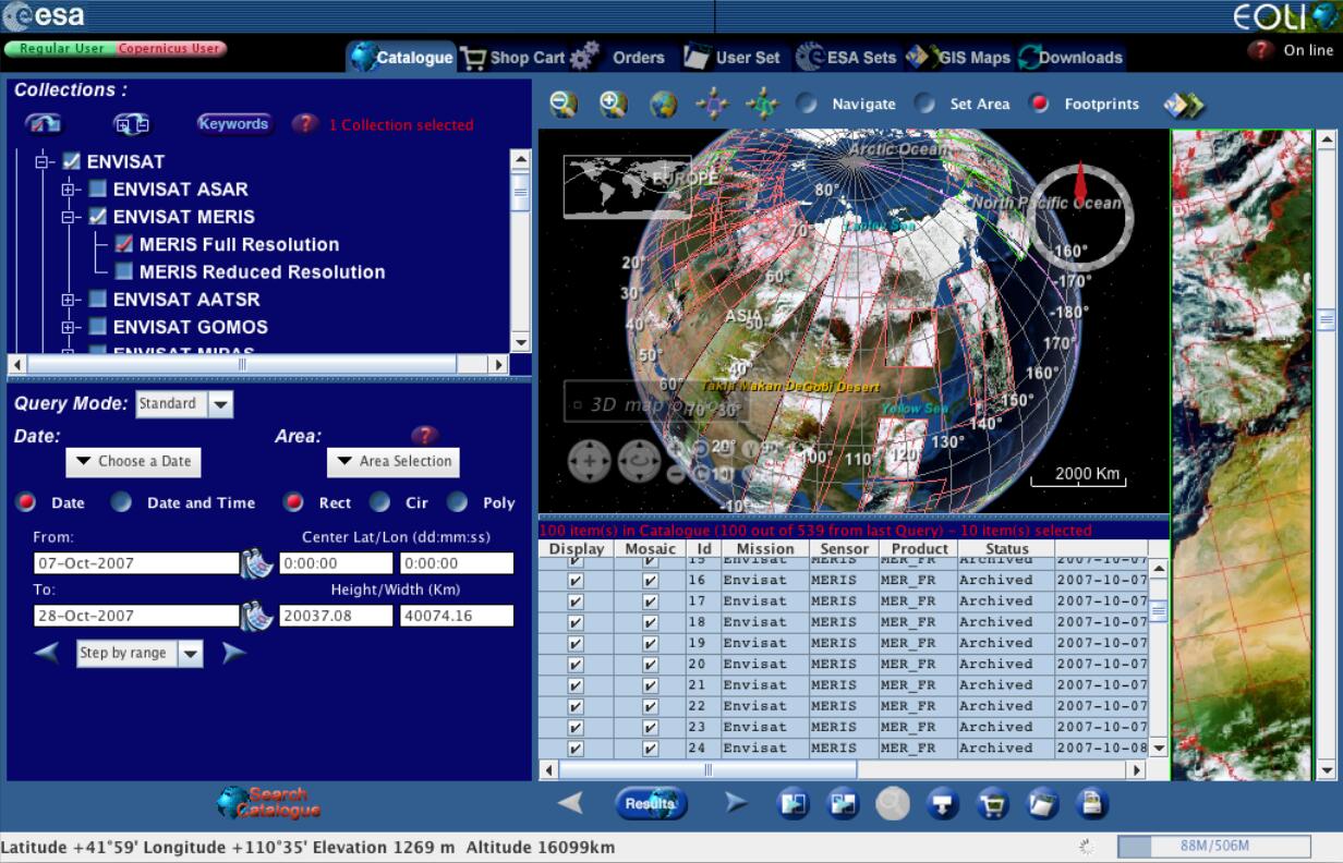
Lets begin with some long-lived apps that have survived quite some Internet hypes, in particular ESA's good old EOLi-SA (opens new window), short for Earth Observation Link - Stand Alone. EOLi-SA is basically a classical catalogue client allowing also to order and sometimes download search results. In an attempt to be platform independent it is implemented as Java app. The main characteristics are the various forms and widgets to specify search criteria together with the big red Search Catalogue button at the bottom left. In general EOLi-SA is quite powerful and feature rich, although sometimes they are quite difficult to find.
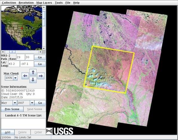
USGS provides GloVis (opens new window), a Java app, to access Landsat data. Take a look at the image and guess the first release date 😉
Another dinosaur in the field is DataDoors (opens new window) a Silverlight app with lots of buttons at the top. It provides a complete management suite for data providers including management of users, products, orders, etc.
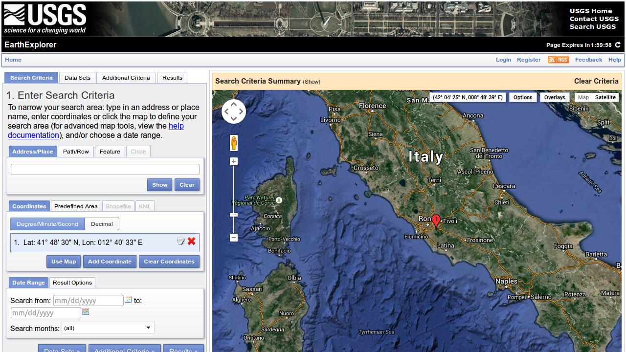
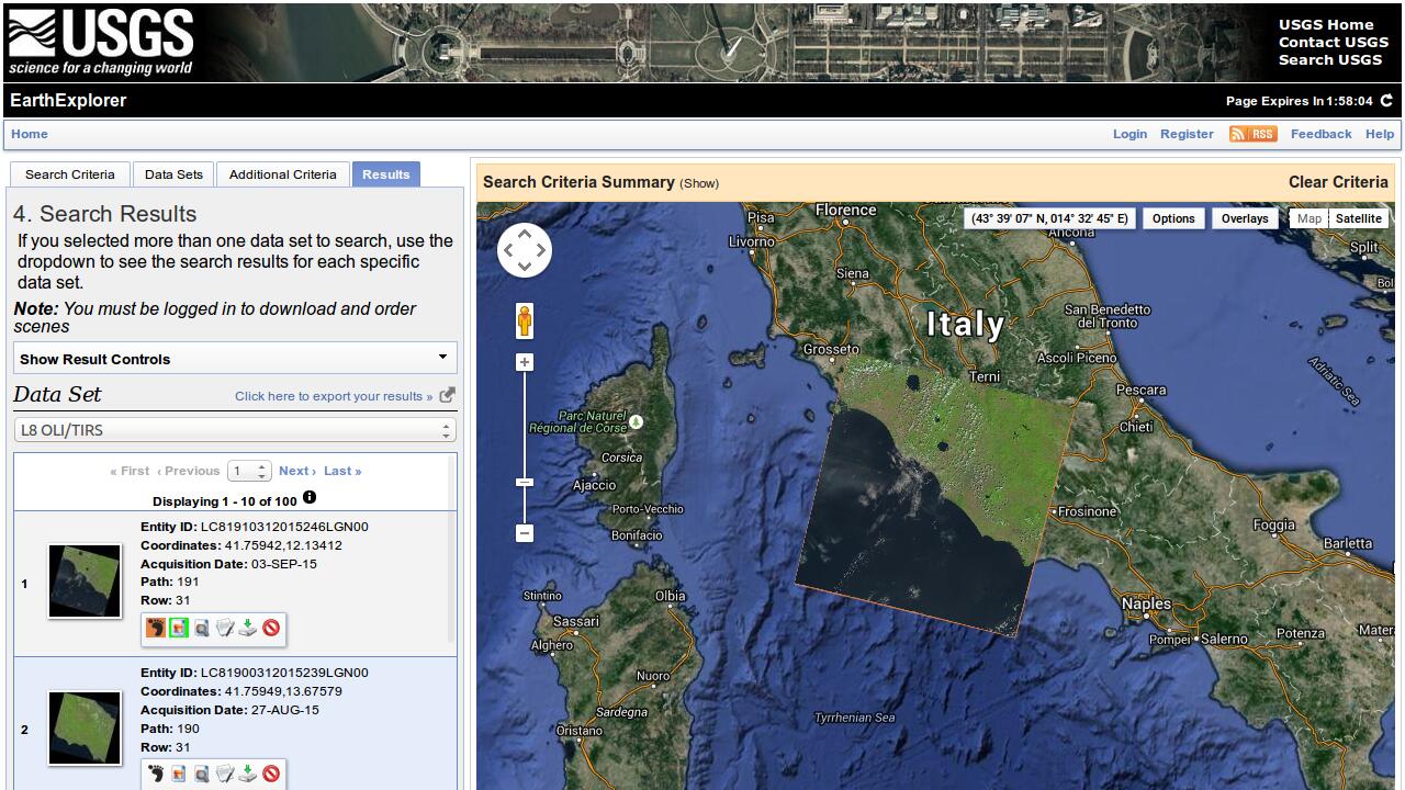
Also from USGS is the EarthExplorer (opens new window), another classic catalogue client with the need to explicitly specify area of interest, time of interest, and other search criteria.
Something that these interfaces have in common, is that the user has to explicitly specify search criteria like area of interest before getting to see the data. Lets take a look at apps that don't have that need.
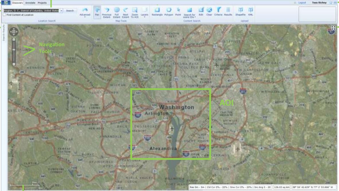
I want to start with ESA's ngEO client. ngEO is short for next generation Earth Observation system. Area of interest and time of interest are automatically taken from the map extent and timeslider selection and searches are performed in the background transparent to the user. Browse images of the data are shown for user selected products.
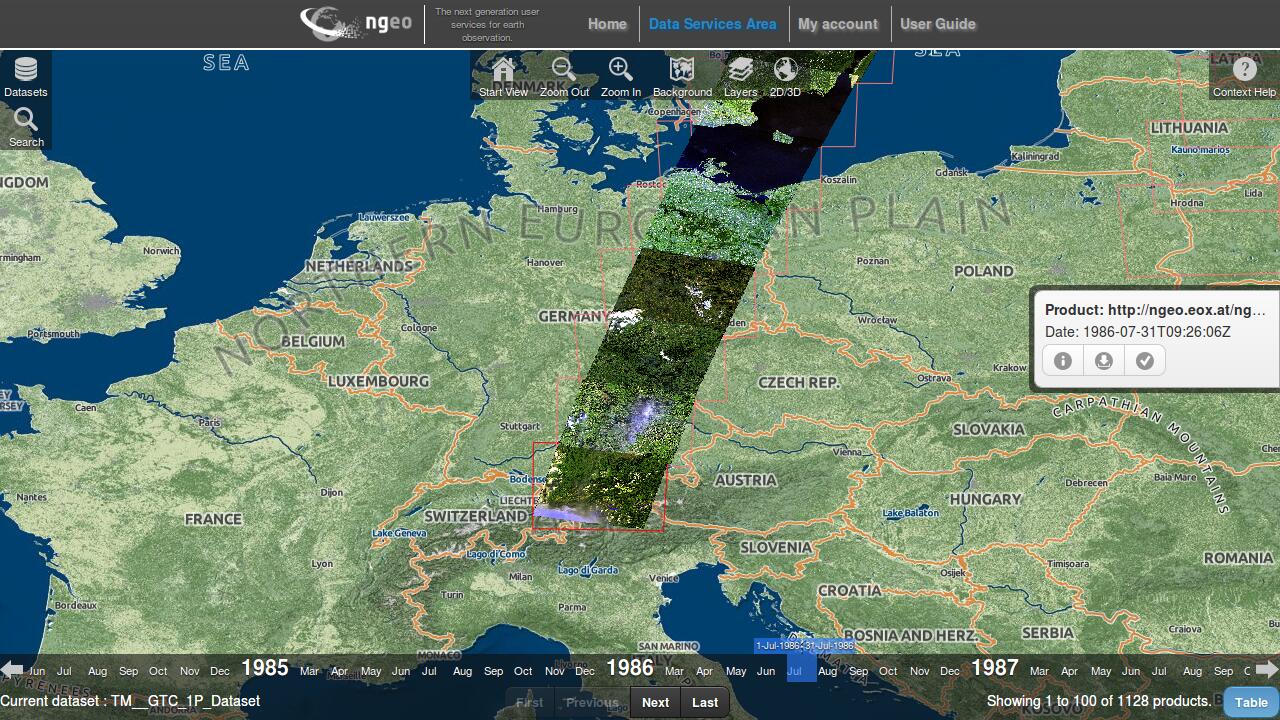
The ngEO system is not yet in operational use although preparations for Sentinel data are ongoing. But there is an online demo (opens new window) with Landsat data available.
The ngEO client still allows the user to explicitly specify search criteria and list the search results, but this is not required.
In my opinion the ngEO client is a great advancement from the apps above, but why not show the search results automatically on the map?
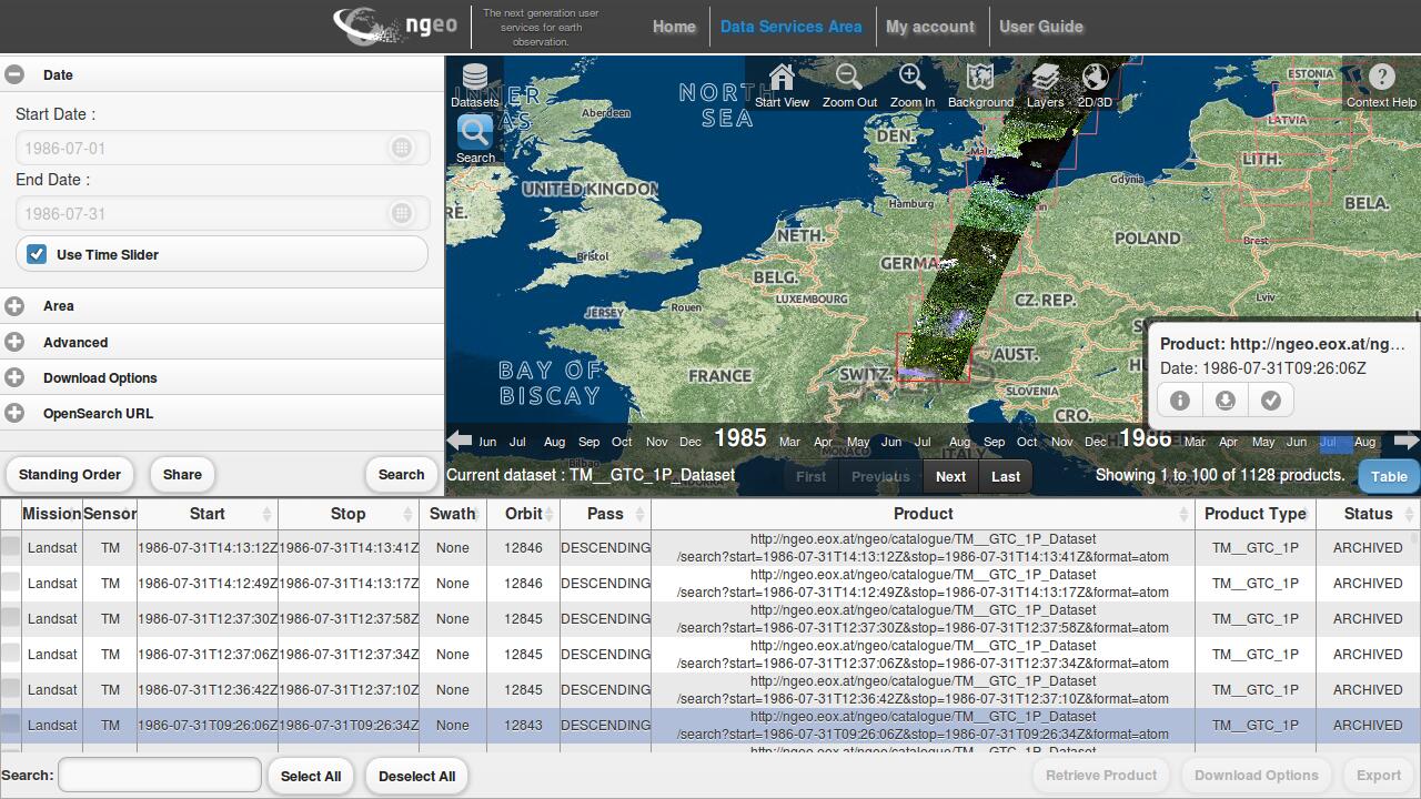
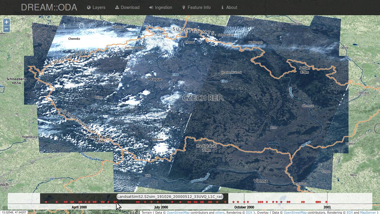
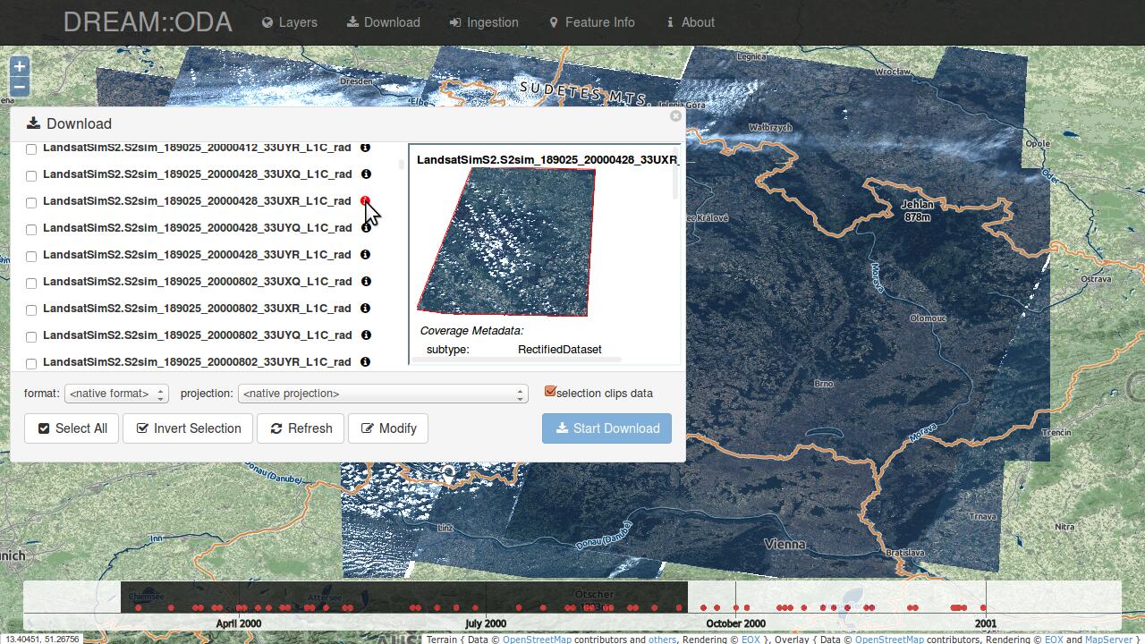
In the frame of ESA's DREAM project we use the EOxClient (opens new window) as the DREAM::ODA (Online Data Access) client. The first image shows the available Landsat data in the current map view for the selected time interval, without any need for the user to specify search criteria or to explicitly perform a search. The second image shows the result list as a preparatory step for downloading the data.
Unfortunately I can't provide a link to the app since we also had to use some restricted data. Ping me if you want further information.
Did you note the background maps? Both apps are using our EOX::Maps (opens new window). Sorry for the shameless plug.
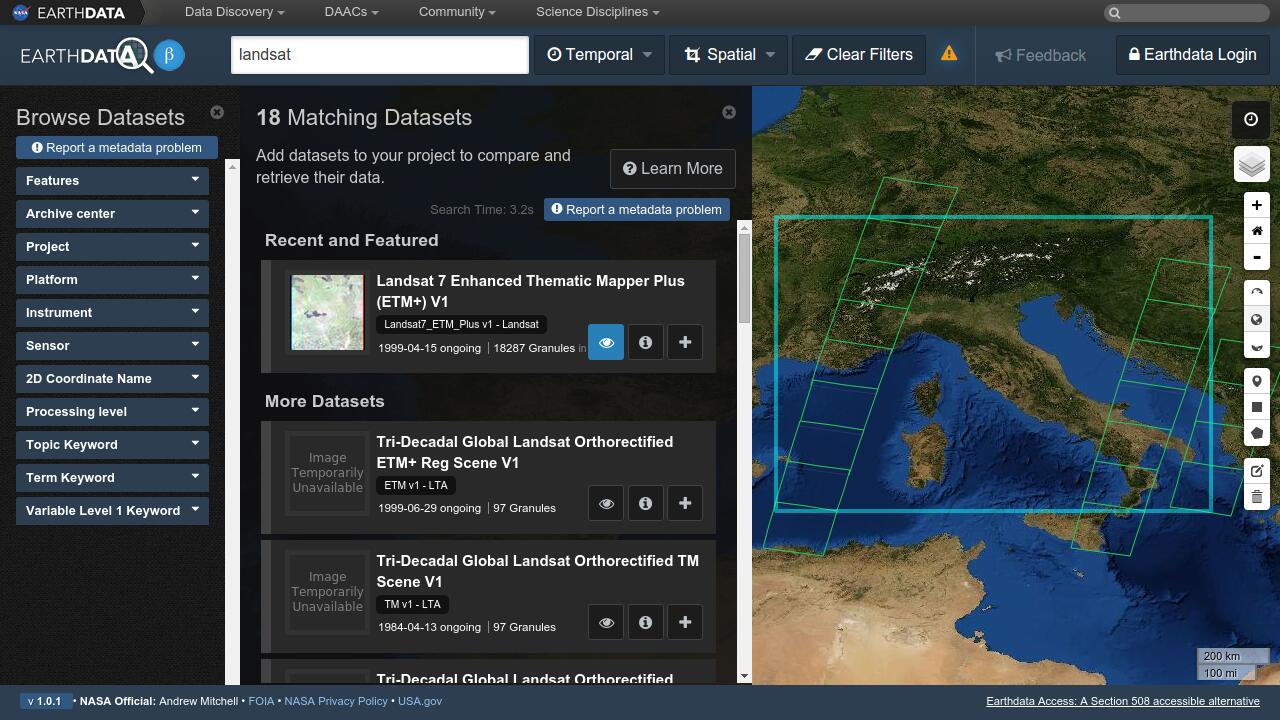
NASA's latest EO data access client is named Earthdata (opens new window) and provides a nice interface to search in a rather classical way.
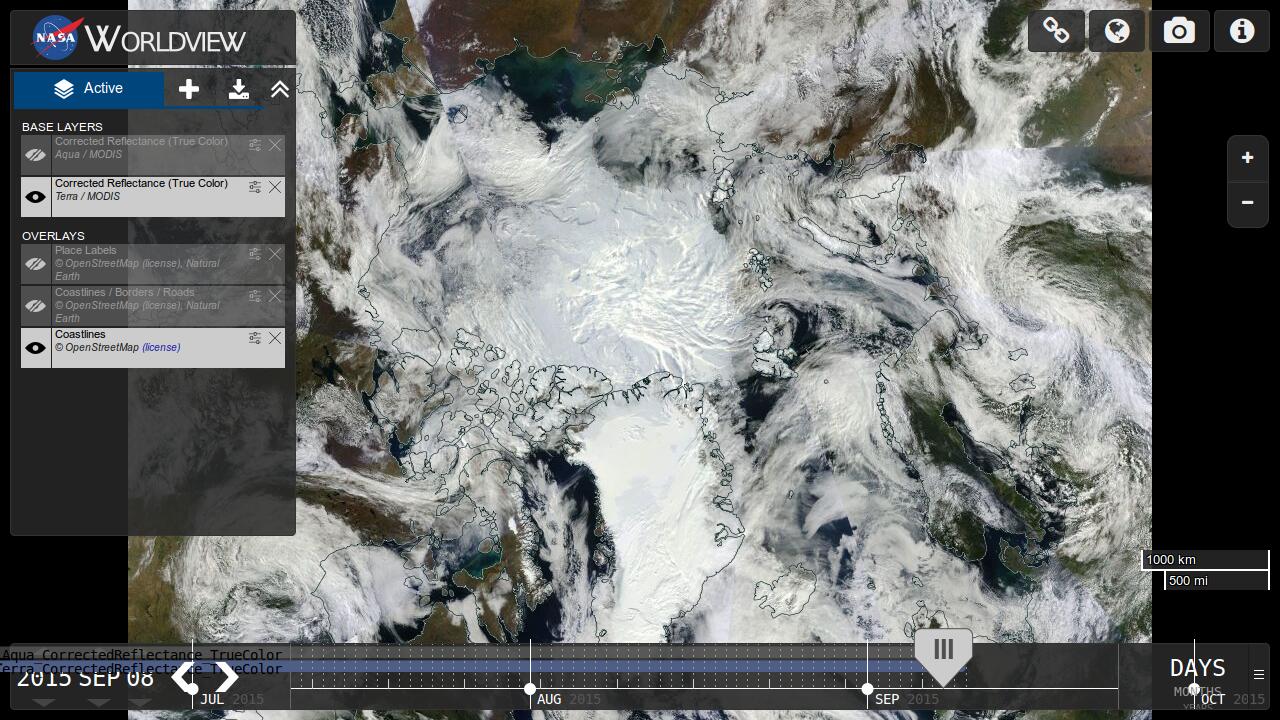
In order to view latest Landsat data on a map, NASA provides its GIBS (opens new window) (Global Imagery Browse Services). GIBS is used in Worldview (opens new window) as shown here in a polar projection. Note the functionality to scroll through the data in time at the bottom.
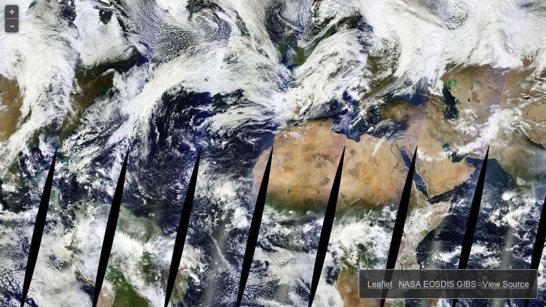
Another example of GIBS usage is as map layer in Leaflet (opens new window), a popular web map client written in Javascript.
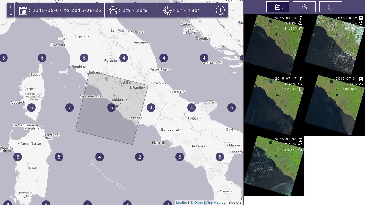
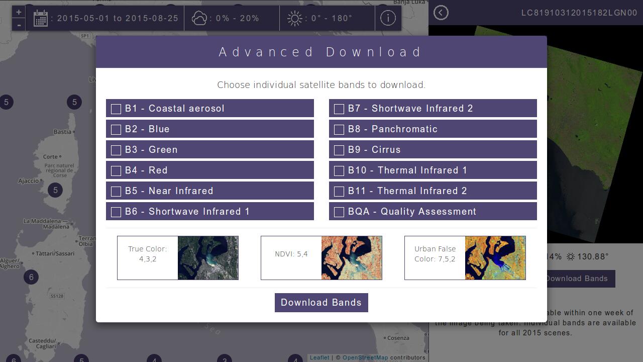
A nice interface to browse and access Landsat data is Libra (opens new window), developed by Development Seed (opens new window) and Astro Digital (opens new window). By just zooming in on the map the user gets access to the full Landsat archive and can directly download individual scenes band by band or as different RGB variants.
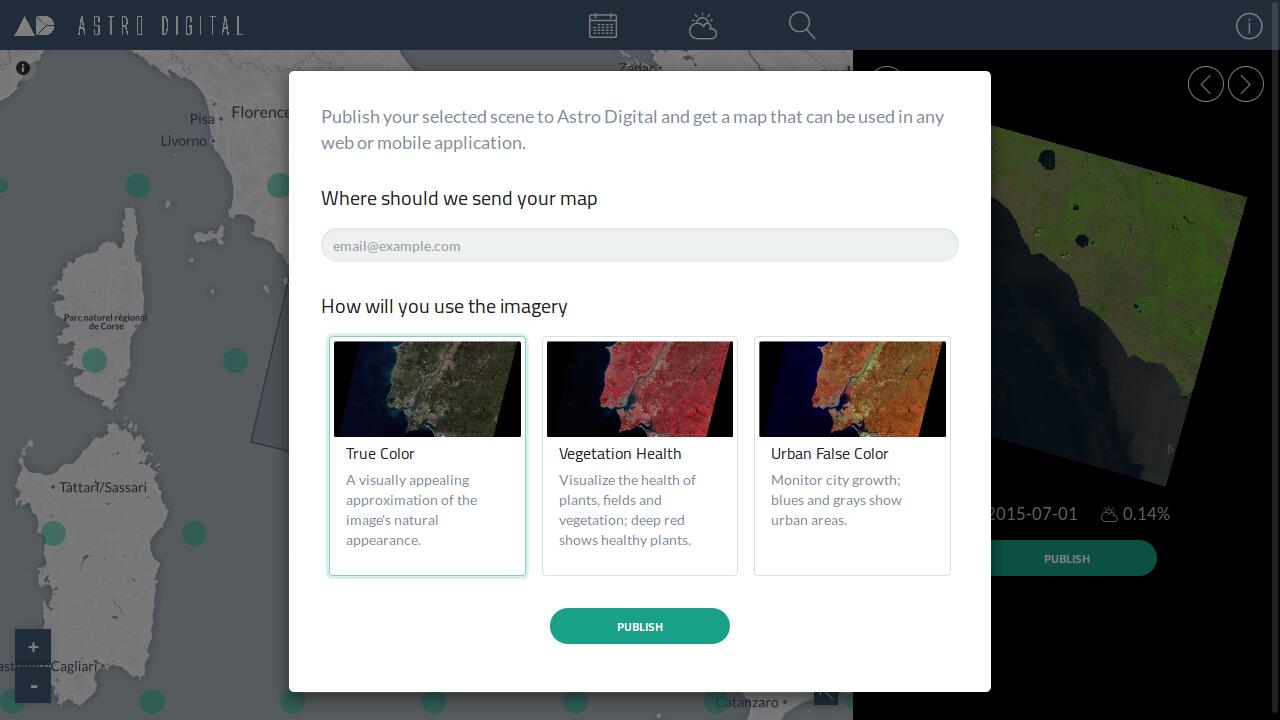
Astro Digital (opens new window) adds the functionality to publish Landsat data as custom map ready to use in your application.
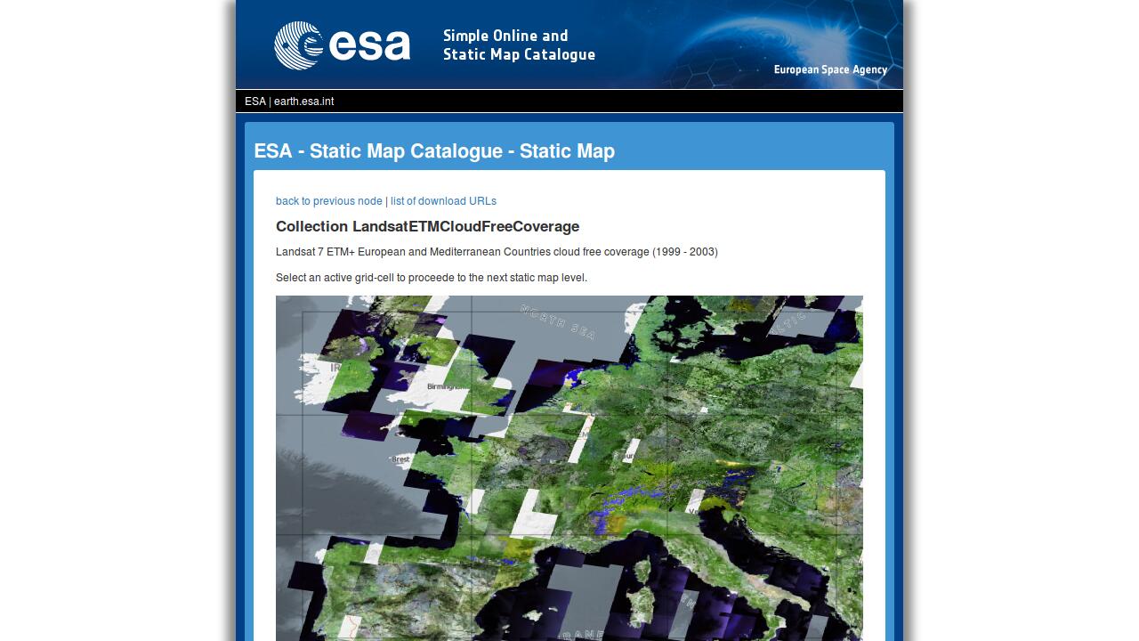
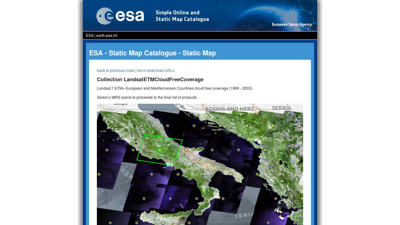
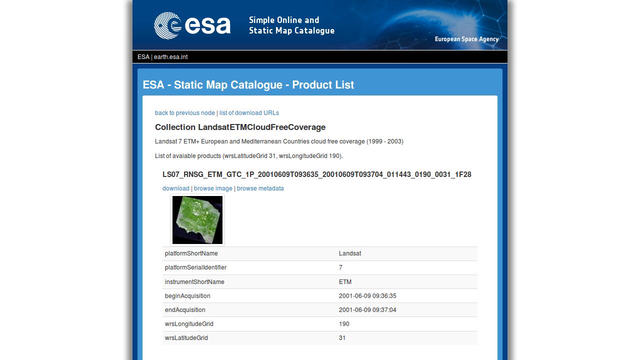
A simple and for performance optimised interface is the SM-Cat which was detailed in a previous post (opens new window) by Fabian. Just take a look a the images to see how to get to the full Landsat data with just three clicks or try it yourself (opens new window).
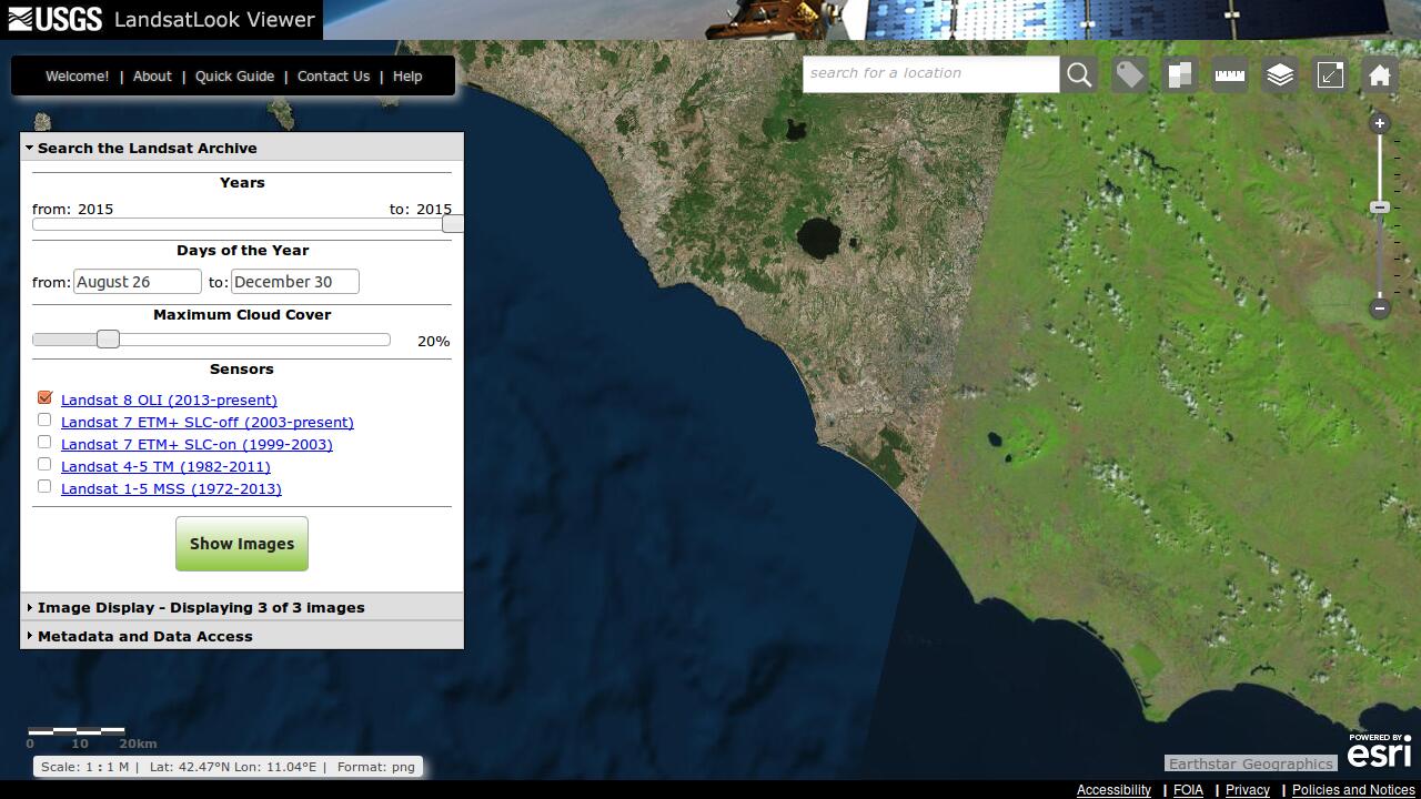
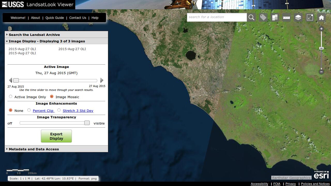
USGS's LandsatLook (opens new window) is another modern app with zoom-to-data and mosaic download functionality.
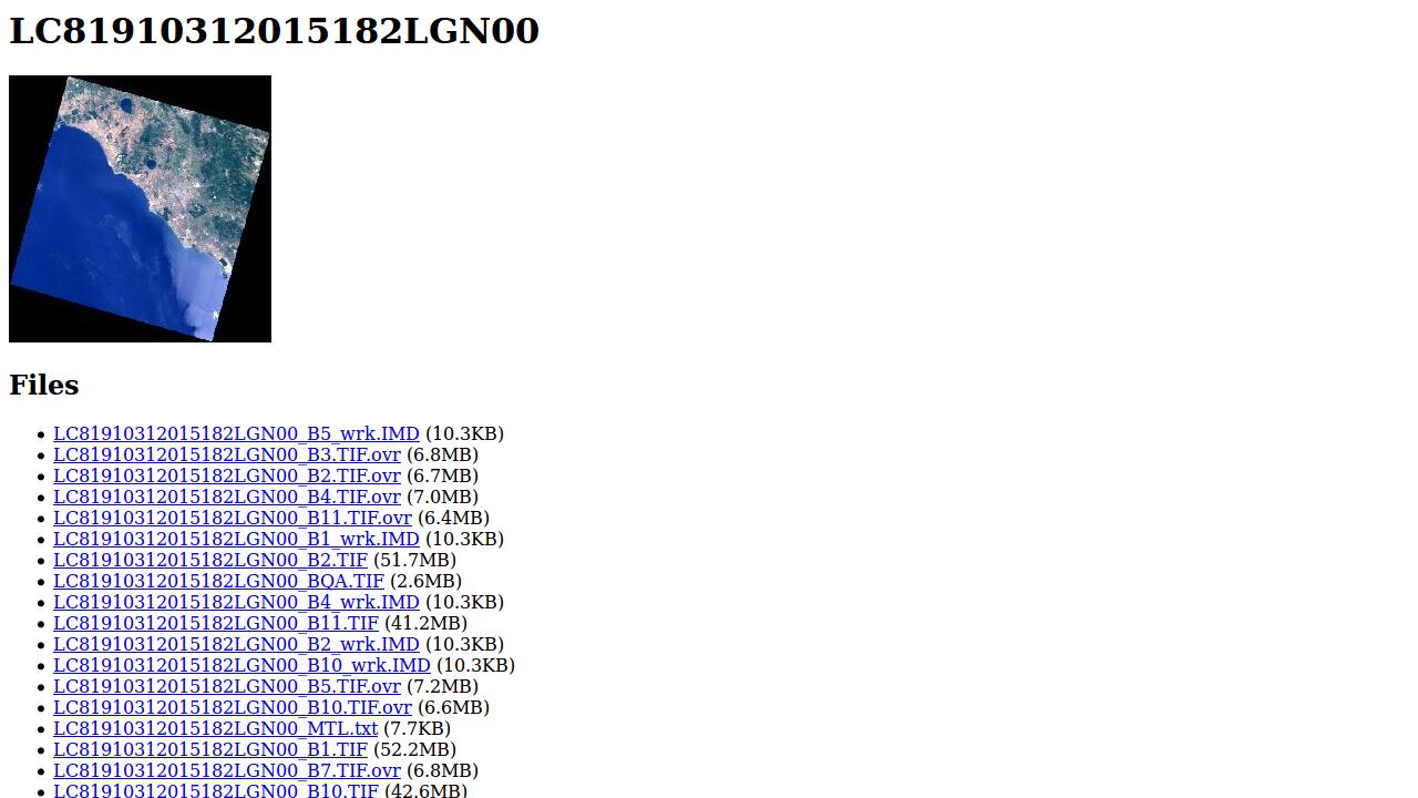
The full Landsat 8 data is available on Amazon's S3 (opens new window). The data is provided via a simple HTTP API on top of which very basic interfaces are available as shown in the image below. Nevertheless this API is important as numerous apps are built on top of this offering. Some of them are shown below.
A really interesting project is Remote Pixel (opens new window) where various small apps are provided to play with Landsat data. Note that the most recent data is always available due to the connection to Amazon's S3 offering. The following images show some of those apps.
Finally I'd like to show some commercial uses of the open Landsat data.
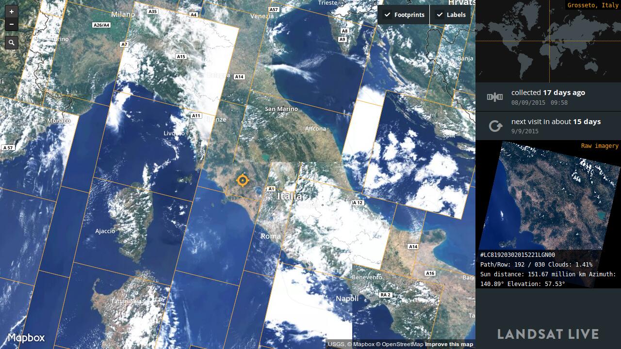
First there is Mapbox (opens new window), which besides their global satellite map derived from Landsat, offers a Landsat Live (opens new window) map layer. This map shows the latest available Landsat image as well as the corresponding metadata for each location on Earth.
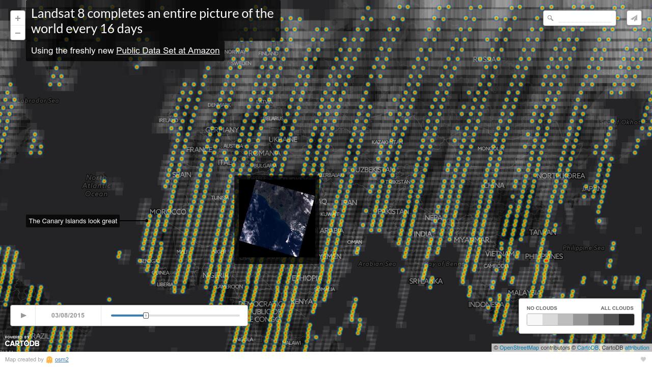
At CartoDB I found another interesting usage of Landsat data. The provided animation shows which areas are acquired by Landsat over time. In addition links to Amazon's S3 are provided to preview and download the data.
Another example of a great usage of Landsat data is by PlanetLabs (opens new window) where they use a Landsat 8 mosaic for geo-referencing their own data. Unfortunately they made me sign a pretty restrictive NDA before allowing access to their interfaces. Thus I can't provide an example view.
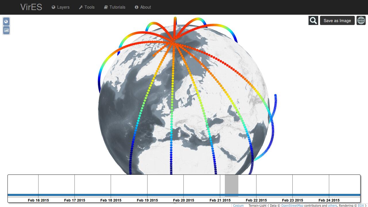
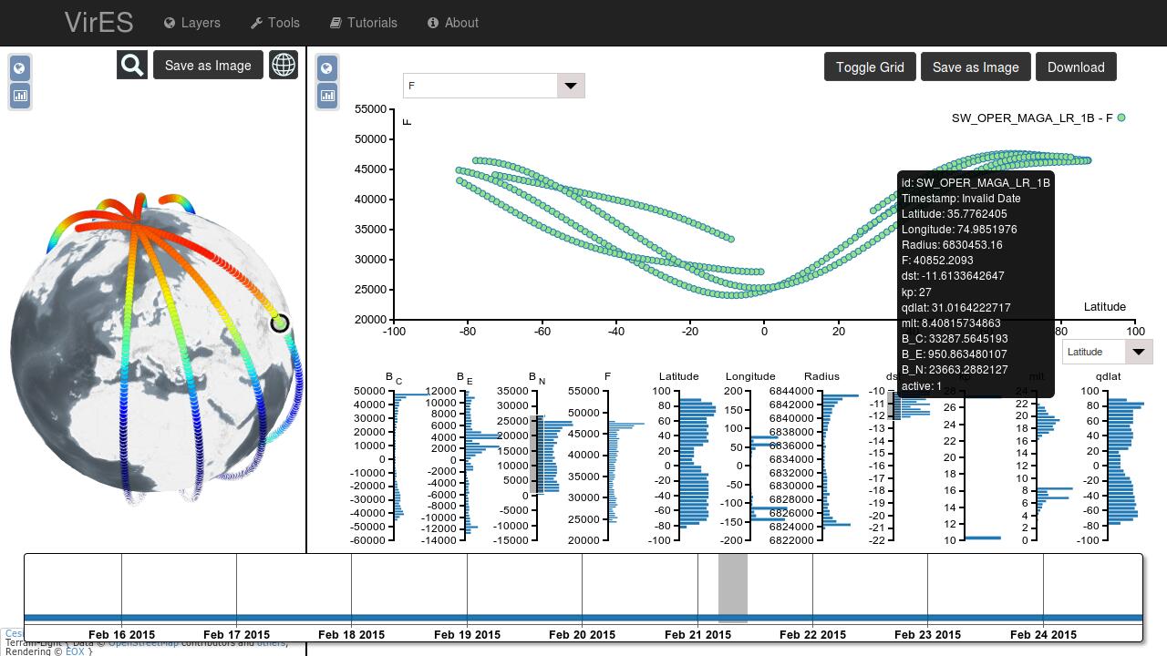
To conclude the examples I include a sneak peek on an interface to access data from ESA's Swarm (opens new window) mission. Though this is not a classical Earth Observation mission, as it measures the Earth magnetic field at the satellite's position, the VirES workspace interface includes some interesting features. As you can see most of the concepts shown above can also be used for very specific data.
I leave you with the images of the VirES workspace and invite you to check back for details provided in a future post, most probably by Daniel.
# Analysis
In the examples shown only the classical search interfaces at the beginning use the map as support for the mandatory area of interest specification. All others automatically take the currently visible area.
I see two classes of apps, those where search criteria need to be explicitly entered and searches are triggered by the user and those where searches are performed transparent to the user in the background.
Further there are those apps with loads of buttons in the beginning compared to those with basically only the map later on. In my opinion those complex user interfaces take too long to learn for non-expert users. On the other side the single purpose apps with only a few buttons are easy to play with and invite also non-expert users for investigation.
All apps, besides the first three, are browser based and thus more or less platform independent. Most of the apps are even running on mobile devices.
As perspective for the future I see a large number of very specialised apps for single use cases. Non-expert users will not have to deal with the details of EO data but get answers to their specific questions form these single purpose apps right away.
# Conclusions
Again, my personal top 5 trends in EO data access and usage are:
- simple apps, in terms of user interface, for single use cases are popular and are more and more replacing the generic, monolithic, multi-purpose clients
- apps are browser based, using latest Internet technologies like HTML5 or WebGL, for platform independence even including mobile devices
- more and more EO data is released as Open Data for the benefit of numerous communities like OpenStreetMap
- the map becomes the central user interface element to view the EO data instead of only supporting the area of interest specification
- there are more commercial opportunities, also for smaller companies, coming up with the availability of Open Data like those from Landsat and the Sentinels, particularly from Sentinel 2
Thanks for reading this far. Do you agree with the analysis? Do you think I missed something important? What are your top trends? Please let me know your thoughts, best via Twitter.